One Las Vegas Condo Policy Priced Its Earthquake Load from a Topographical Survey of the Lot

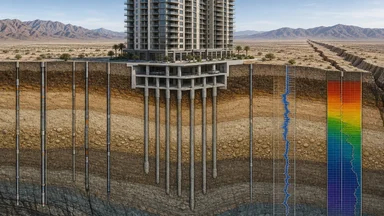
When a Las Vegas condo association received its renewal quote for earthquake insurance in early 2024, the board expected a modest increase. Instead, the annual premium had jumped from roughly $45,000 to $72,000—a 60% spike that no one on the board could explain. The carrier cited a single factor: a topographical survey of the lot, commissioned the previous year to settle a dispute over foundation cracks, had reclassified the soil from a generic Class D to a site-specific Class E, with soft alluvium and a shear-wave velocity 30% lower than the original assumption. That survey, costing around $1,800, became the most expensive document the association ever bought. The survey transformed the association's insurance economics.
The Lot Itself Becomes a Pricing Variable
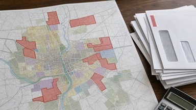
Earthquake insurance has always been about location, but the resolution of that location is getting finer. For decades, carriers used ZIP-code-level risk scores, sometimes even county-level averages. A condo tower in the Las Vegas Strip corridor would be lumped with thousands of other properties, all paying the same base rate regardless of what sat beneath their foundations. That approach is now obsolete.
The shift began when studies showed soil composition varies dramatically within a single block. A 2022 study by the Nevada Bureau of Mines and Geology found that liquefaction risk—the tendency of saturated soil to behave like liquid during shaking—changes by a factor of three over distances as short as 100 meters. Alluvial fans, ancient riverbeds, and compacted fill create micro-zones that a ZIP code cannot capture.
Topographical surveys, once the domain of civil engineers and construction lenders, are now feeding directly into actuarial models. The survey for the Las Vegas condo included borehole logs to depths of 30 meters, measuring shear-wave velocity and groundwater depth. Those numbers entered a catastrophe model from RMS (Risk Management Solutions), which then recalculated the expected annual loss for that specific parcel.
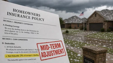
The result: a 40% surcharge on the earthquake load, applied mid-term because the policy allowed re-rating upon new information. The carrier, a regional mutual insurer, had filed a proprietary rate tier with the Nevada Division of Insurance in 2021 that explicitly allowed for site-specific soil adjustments. The board had no recourse.
Why a Standard Policy Doesn’t Fit a Desert Fault Zone
Nevada is the third most seismically active state in the U.S., behind Alaska and California. The Sierra Nevada fault zone and the Walker Lane seismic belt run through the state, and Las Vegas sits on a basin of sedimentary fill that amplifies shaking. Yet standard policies under ISO base rates assume a national average that smooths out local extremes.
ISO's earthquake coverage, typically an endorsement to a commercial property policy, uses a rating factor based on a building's location within a broad seismic zone—Zone 3 or 4 in the old Uniform Building Code classification. That system was designed for structural engineering, not insurance pricing. It ignores soil amplification, basin effects, and site-specific ground motion return periods.
Carriers writing earthquake coverage in Nevada have moved away from ISO forms toward proprietary models. The Nevada DOI has approved at least a dozen rate deviations since 2020 that allow carriers to use site-specific inputs, including shear-wave velocity, liquefaction potential, and even the presence of active faults mapped within 500 meters of the lot. The Las Vegas condo's carrier was one of them.
The 500-year return period becomes a very different number when the soil amplifies waves by a factor of 2.5. The survey proved that amplification existed, and the premium followed.
The Actuary's Inputs: From USGS Data to Dollar Signs
An earthquake insurance premium is built from a chain of actuarial inputs, each with its own uncertainty. At the base are the U.S. Geological Survey's national seismic hazard maps, which provide peak ground acceleration (PGA) values for a given return period. For the Las Vegas area, the USGS maps show a PGA of roughly 0.2g to 0.3g for a 2% probability of exceedance in 50 years—moderate by California standards, but significant for a basin that amplifies motion.
The next input is the building itself. Height matters: taller buildings have longer natural periods, which can resonate with certain earthquake frequencies. Year built determines the applicable building code; a structure from the 1980s, before Nevada adopted more stringent seismic provisions, will have a higher vulnerability curve. The Las Vegas condo was built in 1995, with a concrete shear-wall core and a steel frame—moderately resistant, but not up to modern standards.
Wood-frame versus concrete shear walls is a critical distinction. Wood-frame buildings are more flexible and can absorb energy, but they are also more prone to collapse in strong shaking. Concrete shear walls are stiffer and resist lateral forces, but they can fail in brittle modes if not properly reinforced. The condo's concrete construction earned a slight discount, but the soil class overwhelmed that benefit.
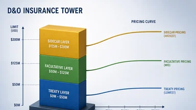
Reinsurance costs are embedded in every load. The carrier's own reinsurance treaty—the layer that covers losses above a certain threshold—is priced using the same cat models. If the model says the condo has a higher probability of a total loss, the reinsurer charges more, and that cost flows back to the policyholder. A 2023 report from the Nevada DOI noted that reinsurance costs accounted for roughly 30% of earthquake premiums in the state, and that percentage is rising as global cat bond markets tighten.
The actuary also includes a load for expenses and profit, typically 20-30% of the pure risk premium. The final number is the sum of all these layers, divided by the number of insured units. For the Las Vegas condo, the pure risk premium doubled after the survey, and the final loaded premium rose 60%.
How a Single Survey Shifted the Risk Score
The original rating for the condo tower assumed a soil class of D, which is the default for "stiff soil" in the National Earthquake Hazards Reduction Program classification. Class D has a shear-wave velocity range of roughly 180 to 360 meters per second. The borehole logs from the topographical survey showed velocities in the range of 120 to 200 meters per second, with an average of 150 m/s—firmly in Class E, or "soft soil."
The drop in shear-wave velocity has a direct effect on the building's response to ground motion. Soft soils amplify low-frequency waves, which are the ones that damage tall buildings. The RMS model used by the carrier estimated that the probability of collapse for a 10-story concrete building on Class E soil was roughly double that on Class D soil, for the same PGA input.
The survey also revealed a shallow groundwater table at 6 meters, within the zone that can trigger liquefaction during shaking. Las Vegas's water table has risen in recent decades due to reduced groundwater pumping, a phenomenon documented by the U.S. Geological Survey. That rising water table increases liquefaction risk, and the survey captured it.
The re-underwriting triggered by the survey was unusual but not unprecedented. The policy's terms allowed the carrier to adjust rates based on "material changes in risk characteristics." The board argued that the survey was not a change in risk but a discovery of pre-existing conditions. The carrier countered that the risk had always been higher; the survey merely measured it. The Nevada DOI declined to intervene, noting that the policy language was unambiguous.
The Condo Association's Hard Choice: Pay or Self-Insure
Faced with a $27,000 annual premium increase, the board of the 40-unit condo association explored alternatives. The first option was to shop the risk to other carriers. Two admitted carriers declined to quote, citing the soil class. A third offered a policy at $68,000—only slightly less than the renewal—with a 10% deductible, meaning the association would pay the first $1.2 million of any earthquake loss.
The board then considered a captive arrangement, where the association would form its own insurance company to cover the risk. Captives are common among large commercial entities but rare for condo associations. The upfront cost to capitalize a captive in Nevada was estimated at roughly $200,000, plus annual operating expenses of $15,000. The board calculated a break-even of about seven years, assuming no major quake.
Lloyd's syndicates offered a non-admitted policy at three times the admitted rate, or roughly $216,000 annually, with a 15% deductible. That option was quickly rejected. The state's FAIR Plan, which serves as an insurer of last resort for property in high-risk areas, explicitly excludes earthquake coverage. The association was stuck.
In the end, the board voted to accept the renewal, but with a plan to commission a full structural retrofit study. Retrofitting the building to modern seismic standards—adding steel bracing and base isolators—could cost $1.5 million, but it might reduce the premium load by 30-40% in future years. The survey had not only raised the premium; it had forced a long-term capital decision.
What This Means for Any Property Owner in Active Seismic Zones
The Las Vegas condo's experience is a harbinger of a broader trend in earthquake insurance: the move toward per-parcel pricing based on site-specific data. Property owners in seismic zones—from the Pacific Northwest to the New Madrid region in the Midwest—should expect their premiums to become more granular and more volatile as carriers adopt these models.
A topographical survey can be cheaper than a decade of higher premiums. For a single-family home, a basic soil survey costs roughly $800 to $1,500, depending on depth and location. If the survey reveals favorable soil conditions—say, dense gravel or bedrock—the homeowner can present that evidence to the carrier and potentially negotiate a lower rate. Conversely, if the survey reveals poor soil, the homeowner at least knows the true risk and can plan accordingly.
Retrofitting may lower the load factor. Seismic retrofits, such as bolting the structure to its foundation or adding shear walls, can reduce the vulnerability curve in the cat model. Some carriers offer credits for retrofits, typically 10-20% off the earthquake premium. The Las Vegas condo association is exploring this route, but the upfront cost is substantial.
Property owners should ask carriers for the ISO risk score breakdown or the internal rating factors used to price their policy. Under Nevada law, insurers must disclose the primary rating factors upon request. That disclosure might include soil class, building height, year built, and construction type. Knowing which factors drive the premium allows the owner to challenge or improve them.
Shop carriers that use site-specific models. Not all insurers have adopted per-parcel pricing. Some still use ZIP-code averages, which may work in the owner's favor if the lot is on better soil than the surrounding area. A 2023 survey by the Nevada DOI found that five of the top ten earthquake writers in the state used site-specific models, while the rest used territorial rating. The difference in premium for identical buildings on adjacent lots can be 20% or more.
The Future of Earthquake Pricing Is Per-Parcel, Not Per-ZIP
California's Earthquake Authority (CEA), the state's largest earthquake insurer, already uses soil maps to adjust premiums. The CEA's rating system assigns each property a soil class based on USGS maps and, where available, site-specific data. In 2022, the CEA updated its rating algorithm to incorporate lidar-derived topography, which can detect subtle features like fault scarps and liquefaction-prone basins.
Oregon is exploring lidar-based risk tiers for its own earthquake insurance pool. The Oregon Department of Geology and Mineral Industries has completed lidar surveys for roughly 60% of the state, at a resolution of one meter. That data can be used to identify landslide-prone slopes and soil amplification zones. The state expects to publish a new hazard map in 2025 that will feed into insurance rates.
Utah saw roughly 15% of its earthquake policies re-rated in 2023 as carriers adopted new models after the 2020 Magna earthquake, a magnitude 5.7 event that caused $50 million in damage. The Utah Geological Survey noted that the quake revealed unexpected liquefaction in areas previously considered low-risk. Carriers responded by re-underwriting their entire Utah book, with some policyholders seeing premium increases of 50% or more.
FEMA's Risk Rating 2.0, implemented for flood insurance in 2021, pushed the entire industry toward more granular pricing. While Risk Rating 2.0 applies only to flood, the principle—that a property's specific characteristics, not just its zone, should determine the rate—has influenced earthquake and wildfire pricing as well. Lidar surveys now cost under $2,000 per lot, making site-specific data economically feasible for carriers to demand or for property owners to provide.
The Las Vegas condo tower is not an anomaly; it is an early data point in a shift that will affect millions of property owners in seismic zones. The days of ZIP-code-based earthquake insurance are numbered. The ground beneath the building is becoming the most important variable in the premium equation.
This article is for informational purposes only and does not constitute insurance, legal, or financial advice. Property owners should consult a licensed insurance professional to evaluate their specific coverage needs and options.